


Measurements of high and low tides taken more than 200 years ago as part of the design of Dry Dock 1 in the Charlestown Navy Yard are now helping climate researchers better understand the pace of rising sea levels in Boston Harbor – information that is crucial to preparing the city for the future impacts of flooding tides along its waterfront.
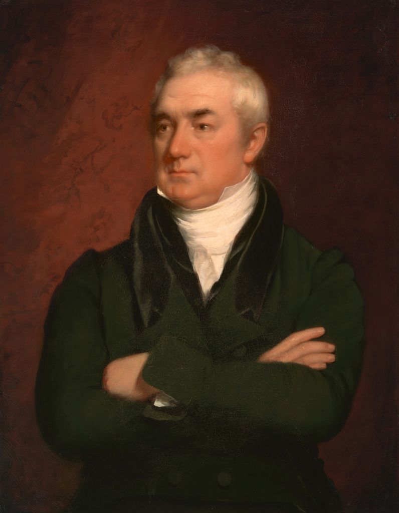
The data was collected starting in 1826 by Massachusetts-based civil engineer Loammi Baldwin Jr., who was hired by the Navy to design and build new dry docks — large basins that can be flooded and drained to repair ships below the waterline — for warships at navy yards in Boston and Gosport, Virginia.
Dry docks work on simple principles, but require detailed and highly accurate knowledge of the surrounding water levels. To acquire that knowledge, Baldwin began keeping his own tidal observations at Boston’s Charlestown Navy Yard, the homeport for USS Constitution.
While Baldwin’s Dry Dock 1 is still used regularly by USS Constitution, so is the tidal data Baldwin collected in order to build the dry dock. As Boston and the rest of the coastal United States struggle with rising sea levels, Baldwin’s recordings, along with other early tidal measurements taken at the Navy Yard’s Dry Dock 1, have been incorporated by modern climate scientists into their data on historic sea levels to better track the rate of sea level rise.
The first to be built by the Navy in the United States, Baldwin’s dry docks in Massachusetts and Virginia allowed ships to be completely removed from the water for maintenance and repairs to the hull below the waterline. Until that point, USS Constitution and the Navy’s other ships were careened for hull work. Careening involved lightening the ship as much as possible, then using massive block and tackle connecting the masts and the shore to pull the ship over on its side. In addition to only allowing one side of the ship to be worked on at a time, the act of hauling the ship onto its side put tremendous and potentially damaging strain on the rigging and hull. Dry docks replaced that fraught process.
The creation of a standing navy in the 1790s meant the U.S. government now had a growing fleet of ships that would need ongoing maintenance and repairs between deployments. Investing in dry docks would expedite those repairs, allowing the Navy to speed up repair work while causing less stress to the hulls.
Making it Work
Varieties of dry docks that use tides to expose a vessel below the waterline have been around for thousands of years, particularly in locales with very large tidal ranges. Graving dry docks, like Baldwin’s, were adopted in the 1700s, but became more widely feasible and much more efficient with the introduction of steam engines to pump out massive amounts of water from the basin. Pumps meant the basin didn’t need to rely entirely on the falling tide to drain it out, or on laborious and time-consuming manual pumping.
The dry dock basin is open at one end to the harbor. At high tide the ship enters the basin. A caisson, a large hollow, floating gate precisely fit to the opening, is then floated into place at the open end. The caisson is filled with water, sinking it into place and sealing the opening to the basin. Valves connecting the basin and harbor allow the basin water level to fall as the tide drops. Then the valves are closed, and the remaining water in the basin is pumped out, leaving the ship high and dry, while the caisson holds out the harbor beyond.
When it’s time to refloat the ship, valves allow water from the harbor back into the basin until the water level in the basin is the same as outside it. Then, the water is pumped from the caisson, allowing it to refloat and be moved out of the way.
To ensure that the basin is deep enough to accommodate the ships it is planned for, a precise knowledge of the tides and water levels at the site of the dry dock is required.
A time lapse of USS Constitution departing Dry Dock 1 in July 2017.
Baldwin’s Builds a Dry Dock
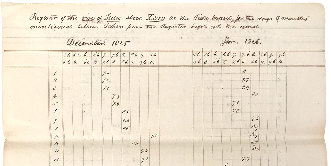
In Boston, Baldwin kept records of the tides for more than 422 days between December, 1825, and July, 1827, before using that information to design the dry dock. Building the complex of masonry, engines, pumps, reservoir, tunnels, culverts, valves, and gates took six years. Between 1830 and 1833, during the latter half of the construction, an additional 26 months of tide measurements were taken at the site.
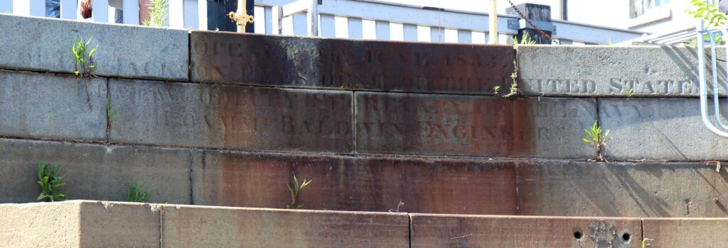
The Charlestown dock was inaugurated in 1833 with the docking of Constitution. From 1858 to 1860, the dock was extended from 341 feet to 357 feet. Then, from 1947 to 1948, it was further lengthened to 415 feet, moving the gate end of the dock further out. While the dock has been altered with new pumps and piping, the overall depth of the dry dock has not changed. Original markings around the edges of the unchanged head of the dry dock are still intact.
Scientists seeking to track sea level rise have largely relied on 20th century recordings by the federal government that began around 1920 and continue to this day. But that data has limited scientists’ ability to gauge changes in the rates of sea level rise over longer periods of time.
In 2018, researchers Stefan Talke, Andrew Kemp and Jon Woodruff began mining historical archives for tidal records that had not been previously included in the statistical data being used for long-term climate patterns. In addition to Baldwin’s measurements made during the design and construction of Dry Dock 1 in the 1820s and 1830s, they discovered that the U.S. Coast Survey had made nearly continuous measurements at the same location at the dry dock from 1847 to 1877, and that the U.S. Navy measured tides there from 1902 to at least 1911. Stored in boxes for more than a century, none of these records had ever been included in the statistics on sea levels in Boston. But because the dry dock is still intact and still has physical marks used as reference points, it was relatively easy for them to fold the historical data into their study.
Loammi Baldwin was interested in making sure his new Dry Dock 1 at the Charlestown Navy Yard would be deep enough to accommodate USS Constitution and other Navy ships needing to be hauled out for repairs. But 200 years later, his precise measurements are continuing to contribute to planning for the safety of Boston in an era of global warming.
__________________________________________
Talke, S. A., Kemp, A. C., & Woodruff, J. (2018). Relative sea level, tides, and extreme water levels in Boston harbor from 1825 to 2018. Journal of Geophysical Research: Oceans, 123.
The Author(s)
Carl Herzog
Public Historian, USS Constitution Museum
Carl Herzog is the Public Historian at the USS Constitution Museum.


